
Hurricane Milton: Will Florida hurricane affect weather in Wakefield, Pontefract and Dewsbury?
The hurricane is expected to travel eastwards across the Atlantic Ocean, this weekend.
Milton is a category four major hurricane, but is likely to slowly weaken as it moves across western Florida and into the Atlantic, the Met Office has shared.
The hurricane is the strongest Atlantic hurricane by pressure since Wilma in 2005, and fifth strongest in the Atlantic, on record, by pressure.
However, despite weakening, Milton is still expected to be a dangerous and destructive as it makes landfall, with sustained winds of around 130mph along the coast and a significant storm surge.
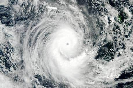

However, over the next few days, Milton will continue to weaken as it moves towards the Atlantic.
It set to no longer be classed as a hurricane by Friday morning as wind speeds will ease to less than 74mph.
Furthermore, it is expected to weaken to a tropical storm once over the open waters of the Atlantic.
It will then transition into an extratropical storm after it passes to the south of Bermuda –which it is expected to do this Saturday (October 12).
Beyond this, the remnant of the hurricane is likely to either be absorbed into a frontal zone or dissipate as it travels across the Atlantic.
However, the Met Office has warned that if the remnants of Milton end up in the Atlantic as a weakening feature, it could cause some forecast uncertainty throughout the region, and across the UK, next week.
Currently, West Yorkshire’s weekend forecast, reads: “After a fine start Saturday, a showery band of rain sinks south, clearing overnight to leave a fine and dry day Sunday and Monday. Staying cool and often breezy.”